|
|
| Point ID: 8477 | Downloads | Plots | Site Data | Code: 10312 |
|
| Download | |
|---|---|
| Site Descriptor Information | Site Time Series Data |
| Link to all available data | |
|
|
|
| View: | Statistics | All |
| Units: | mm |
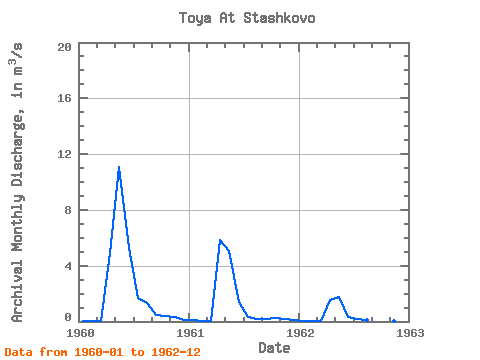
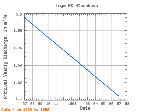
| Year | Jan | Feb | Mar | Apr | May | Jun | Jul | Aug | Sep | Oct | Nov | Dec | Annual | 1960 | 0.07 | 0.07 | 0.06 | 4.88 | 11.10 | 5.24 | 1.66 | 1.31 | 0.50 | 0.38 | 0.30 | 0.14 | 2.14 | 1961 | 0.08 | 0.05 | 0.05 | 5.86 | 5.05 | 1.41 | 0.33 | 0.18 | 0.20 | 0.26 | 0.21 | 0.11 | 1.15 | 1962 | 0.06 | 0.03 | 0.03 | 1.51 | 1.74 | 0.34 | 0.19 | 0.13 | 0.08 | 0.11 | 0.07 | 0.02 | 0.36 |
|---|
 Return to R-Arctic Net Home Page