|
|
| Point ID: 8477 | Downloads | Plots | Site Data | Code: 10312 |
|
| Download | |
|---|---|
| Site Descriptor Information | Site Time Series Data |
| Link to all available data | |
|
|
|
| View: | Statistics | All |
| Units: | m3/s |
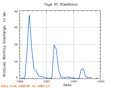
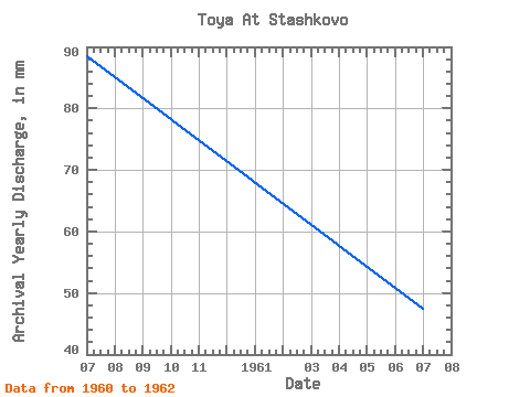
| Year | Jan | Feb | Mar | Apr | May | Jun | Jul | Aug | Sep | Oct | Nov | Dec | Annual | 1960 | 0.23 | 0.21 | 0.22 | 16.56 | 38.91 | 17.78 | 5.82 | 4.59 | 1.70 | 1.33 | 1.02 | 0.49 | 88.49 | 1961 | 0.27 | 0.17 | 0.17 | 19.88 | 17.70 | 4.78 | 1.16 | 0.63 | 0.68 | 0.91 | 0.71 | 0.39 | 47.46 | 1962 | 0.21 | 0.10 | 0.09 | 5.12 | 6.10 | 1.15 | 0.67 | 0.46 | 0.28 | 0.39 | 0.23 | 0.06 | 14.82 |
|---|
 Return to R-Arctic Net Home Page