|
|
| Point ID: 8087 | Downloads | Plots | Site Data | Code: 1512 |
|
| Download | |
|---|---|
| Site Descriptor Information | Site Time Series Data |
| Link to all available data | |
|
|
|
| View: | Statistics | All |
| Units: | m3/s |
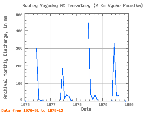
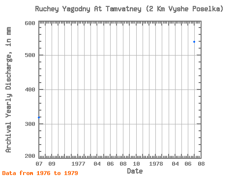
| Year | Jan | Feb | Mar | Apr | May | Jun | Jul | Aug | Sep | Oct | Nov | Dec | Annual | 1976 | 0.00 | 0.00 | 0.00 | 0.00 | 0.00 | 299.97 | 8.32 | 2.39 | 4.33 | 0.00 | 0.00 | 0.00 | 319.07 | 1977 | 0.00 | 0.00 | 0.00 | 0.00 | 7.80 | 187.23 | 13.00 | 35.88 | 26.17 | 3.12 | 0.00 | 0.00 | 275.26 | 1978 | 0.00 | 0.00 | 0.00 | 0.00 | 0.00 | 443.21 | 40.56 | 7.80 | 34.73 | 6.24 | 0.00 | 0.00 | 538.56 | 1979 | 0.00 | 0.00 | 0.00 | 0.00 | 5.20 | 327.65 | 28.60 | 30.16 | 28.69 | 7.80 | 0.00 | 0.00 | 432.04 |
|---|
 Return to R-Arctic Net Home Page