|
|
| Point ID: 5459 | Downloads | Plots | Site Data | Code: 05KH013 |
|
| Download | |
|---|---|
| Site Descriptor Information | Site Time Series Data |
| Link to all available data | |
|
|
|
| View: | Statistics | All |
| Units: | m3/s |
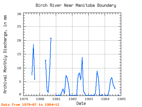
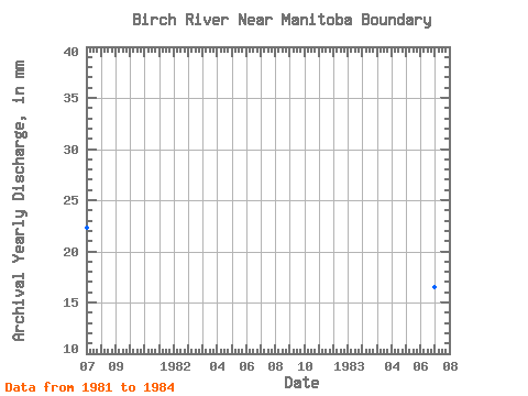
| Year | Jan | Feb | Mar | Apr | May | Jun | Jul | Aug | Sep | Oct | Nov | Dec | Annual | 1979 | 7.75 | 19.05 | 5.98 | 1980 | 13.11 | 1.86 | 1.11 | 9.33 | 20.70 | 1981 | 0.03 | 0.03 | 0.03 | 0.03 | 1.41 | 2.38 | 0.71 | 7.49 | 6.54 | 3.72 | 0.03 | 0.03 | 22.32 | 1982 | 0.03 | 0.03 | 0.03 | 0.03 | 7.36 | 8.22 | 5.86 | 14.27 | 1.62 | 0.66 | 0.03 | 0.03 | 37.80 | 1983 | 0.03 | 0.03 | 0.03 | 0.03 | 0.03 | 1.01 | 9.17 | 6.12 | 0.03 | 0.03 | 0.26 | 0.00 | 16.51 | 1984 | 0.03 | 0.03 | 0.03 | 1.97 | 6.05 | 6.50 | 3.88 | 2.74 | 6.81 | 1.18 | 0.03 | 0.03 | 29.25 |
|---|
 Return to R-Arctic Net Home Page