|
|
| Point ID: 3542 | Downloads | Plots | Site Data | Code: 06MA007 |
|
| Download | |
|---|---|
| Site Descriptor Information | Site Time Series Data |
| Link to all available data | |
|
|
|
| View: | Statistics | All |
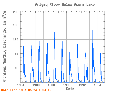
| Units: | mm |
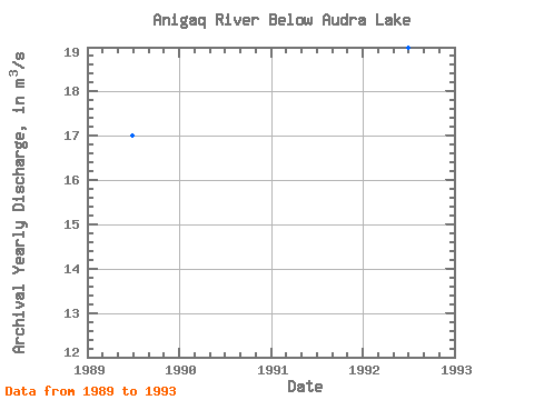
| Year | Jan | Feb | Mar | Apr | May | Jun | Jul | Aug | Sep | Oct | Nov | Dec | Annual | 1984 | 0.00 | 101.00 | 41.20 | 12.40 | 18.60 | 1.85 | 0.04 | 1985 | 0.00 | 102.00 | 45.50 | 32.40 | 35.80 | 7.82 | 0.58 | 0.00 | 1986 | 1.92 | 123.00 | 77.30 | 11.30 | 6.06 | 2.50 | 0.14 | 0.00 | 1987 | 0.00 | 72.20 | 110.00 | 32.60 | 26.90 | 8.63 | 0.53 | 0.00 | 1988 | 0.00 | 140.00 | 48.40 | 10.30 | 8.38 | 4.92 | 0.12 | 0.00 | 1989 | 0.00 | 0.00 | 0.00 | 0.00 | 0.00 | 125.00 | 59.00 | 13.90 | 4.45 | 1.58 | 0.16 | 0.00 | 17.01 | 1990 | 0.00 | 0.00 | 0.00 | 0.00 | 0.02 | 84.30 | 45.00 | 27.30 | 17.30 | 4.53 | 0.77 | 0.01 | 14.94 | 1991 | 0.00 | 0.00 | 0.00 | 0.00 | 0.00 | 106.00 | 30.10 | 6.57 | 4.89 | 3.55 | 0.24 | 0.01 | 12.61 | 1992 | 0.00 | 0.00 | 0.00 | 0.00 | 0.00 | 68.00 | 83.10 | 14.30 | 53.70 | 8.04 | 0.63 | 0.00 | 18.98 | 1993 | 0.00 | 0.00 | 0.00 | 0.00 | 0.00 | 146.00 | 43.90 | 46.90 | 24.40 | 1.73 | 0.12 | 0.00 | 21.92 | 1994 | 0.00 | 0.00 | 0.00 | 0.00 | 0.00 | 81.20 | 19.60 | 5.62 | 0.00 |
|---|
 Return to R-Arctic Net Home Page