|
|
|||||||||||||||||
| Point ID: 500 | Downloads | Plots | Site Data | Code: 05EB016 |
|
|
|||||||||||||||||
| Download | |
|---|---|
| Site Descriptor Information | Site Time Series Data |
| Link to all available data | |
| View: | Time Series | All |
| Units: | m3/s |
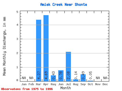
| Statistic | Jan | Feb | Mar | Apr | May | Jun | Jul | Aug | Sep | Oct | Nov | Dec | Annual |
|---|---|---|---|---|---|---|---|---|---|---|---|---|---|
| Mean | 3.86 | 4.15 | 0.37 | 0.69 | 1.83 | 0.13 | 0.43 | 0.04 | |||||
| Standard Deviation | 5.75 | 3.46 | 0.41 | 1.67 | 4.51 | 0.46 | 1.28 | 0.09 | |||||
| Min | 0.00 | 0.04 | 0.01 | 0.00 | 0.00 | 0.00 | 0.00 | 0.00 | |||||
| Max | 17.62 | 11.96 | 1.34 | 6.04 | 15.98 | 2.16 | 4.83 | 0.34 | |||||
| Coefficient of Variation | 1.49 | 0.83 | 1.09 | 2.43 | 2.46 | 3.64 | 2.95 | 2.30 |
 Return to R-Arctic Net Home Page