|
|
|||||||||||||||||
| Point ID: 3692 | Downloads | Plots | Site Data | Code: 10UE001 |
|
|
|||||||||||||||||
| Download | |
|---|---|
| Site Descriptor Information | Site Time Series Data |
| Link to all available data | |
| View: | Time Series | All |
| Units: | m3/s |
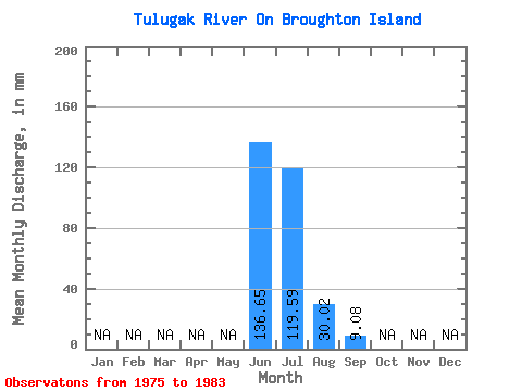
| Statistic | Jan | Feb | Mar | Apr | May | Jun | Jul | Aug | Sep | Oct | Nov | Dec | Annual |
|---|---|---|---|---|---|---|---|---|---|---|---|---|---|
| Mean | 136.70 | 119.53 | 30.04 | 9.09 | |||||||||
| Standard Deviation | 75.68 | 127.80 | 14.52 | 8.86 | |||||||||
| Min | 83.18 | 17.21 | 13.39 | 1.04 | |||||||||
| Max | 190.21 | 288.43 | 53.77 | 21.48 | |||||||||
| Coefficient of Variation | 0.55 | 1.07 | 0.48 | 0.97 |
 Return to R-Arctic Net Home Page