|
|
| Point ID: 5289 | Downloads | Plots | Site Data | Code: 05HD006 |
|
| Download | |
|---|---|
| Site Descriptor Information | Site Time Series Data |
| Link to all available data | |
|
|
|
| View: | Statistics | All |
| Units: | mm |
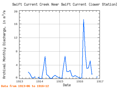
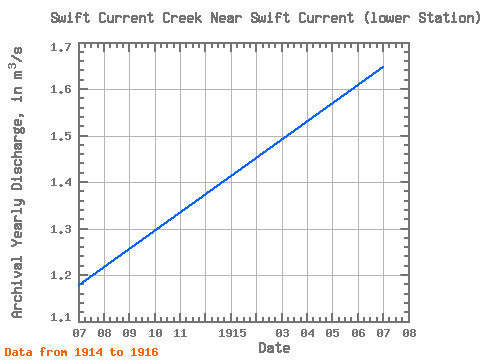
| Year | Jan | Feb | Mar | Apr | May | Jun | Jul | Aug | Sep | Oct | Nov | Dec | Annual | 1913 | 1.90 | 1.37 | 0.34 | 0.21 | 0.47 | 0.30 | 1914 | 0.05 | 0.06 | 2.87 | 6.46 | 1.17 | 0.83 | 0.18 | 0.02 | 0.58 | 1.00 | 0.61 | 0.31 | 1.18 | 1915 | 0.15 | 0.09 | 3.34 | 6.54 | 2.04 | 2.07 | 2.40 | 0.74 | 0.59 | 0.87 | 0.62 | 0.33 | 1.65 | 1916 | 0.12 | 0.29 | 17.30 | 7.31 | 2.97 | 3.15 | 5.23 | 1.30 | 0.76 | 1.31 | 0.47 | 0.34 | 3.38 |
|---|
 Return to R-Arctic Net Home Page