|
|
| Point ID: 2906 | Downloads | Plots | Site Data | Code: 05MG011 |
|
| Download | |
|---|---|
| Site Descriptor Information | Site Time Series Data |
| Link to all available data | |
|
|
|
| View: | Statistics | All |
| Units: | m3/s |
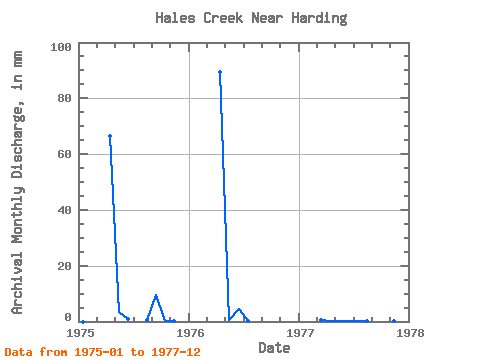
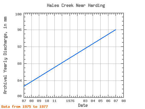
| Year | Jan | Feb | Mar | Apr | May | Jun | Jul | Aug | Sep | Oct | Nov | Dec | Annual | 1975 | 0.00 | 0.00 | 0.00 | 66.45 | 3.41 | 1.01 | 0.00 | 0.49 | 9.54 | 0.36 | 0.17 | 0.00 | 82.49 | 1976 | 0.00 | 0.00 | 0.00 | 89.54 | 0.68 | 4.38 | 0.07 | 0.00 | 0.00 | 0.00 | 0.00 | 0.00 | 96.04 | 1977 | 0.00 | 0.00 | 0.41 | 0.35 | 0.15 | 0.02 | 0.36 | 0.07 | 0.05 | 0.02 | 0.09 | 0.02 | 1.55 |
|---|
 Return to R-Arctic Net Home Page