|
|
|||||||||||||||||
| Point ID: 9311 | Downloads | Plots | Site Data | Code: 15055500 |
|
|
|||||||||||||||||
| Download | |
|---|---|
| Site Descriptor Information | Site Time Series Data |
| Link to all available data | |
|
|
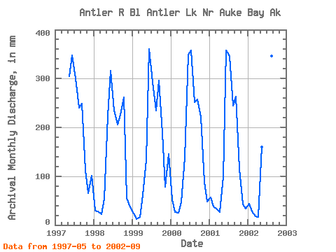
| View: | Statistics | Time Series |
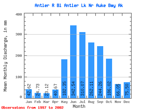
| Units: | m3/s |
| Statistic | Jan | Feb | Mar | Apr | May | Jun | Jul | Aug | Sep | Oct | Nov | Dec | Annual |
|---|---|---|---|---|---|---|---|---|---|---|---|---|---|
| Mean | 42.62 | 24.94 | 23.11 | 40.67 | 182.34 | 342.55 | 310.03 | 262.08 | 244.26 | 186.00 | 66.06 | 75.47 | 1788.41 |
| Standard Deviation | 15.02 | 8.60 | 6.55 | 18.70 | 77.81 | 18.61 | 47.90 | 49.33 | 40.90 | 67.48 | 17.76 | 50.53 | 105.68 |
| Min | 23.92 | 11.85 | 16.46 | 15.85 | 101.48 | 315.73 | 242.45 | 213.14 | 174.78 | 116.68 | 42.93 | 34.45 | 1680.15 |
| Max | 58.71 | 35.93 | 32.82 | 60.86 | 315.43 | 360.30 | 368.91 | 357.30 | 295.58 | 270.21 | 87.46 | 150.52 | 1888.34 |
| Coefficient of Variation | 0.35 | 0.34 | 0.28 | 0.46 | 0.43 | 0.05 | 0.15 | 0.19 | 0.17 | 0.36 | 0.27 | 0.67 | 0.06 |
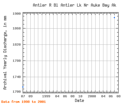
| Year | Jan | Feb | Mar | Apr | May | Jun | Jul | Aug | Sep | Oct | Nov | Dec | Annual | 1997 | 315.43 | 348.26 | 310.54 | 248.54 | 249.46 | 116.68 | 65.91 | 104.53 | 1998 | 30.61 | 26.44 | 22.25 | 53.08 | 229.98 | 315.73 | 242.45 | 213.14 | 225.50 | 270.21 | 55.44 | 38.24 | 1715.88 | 1999 | 23.92 | 11.85 | 16.46 | 60.86 | 138.96 | 360.30 | 303.02 | 241.71 | 295.58 | 194.10 | 78.56 | 150.52 | 1869.27 | 2000 | 54.56 | 24.50 | 25.88 | 46.57 | 142.41 | 349.83 | 368.91 | 259.92 | 256.95 | 229.21 | 87.46 | 49.62 | 1888.34 | 2001 | 58.71 | 35.93 | 32.82 | 27.01 | 101.48 | 357.97 | 358.09 | 251.89 | 263.27 | 119.80 | 42.93 | 34.45 | 1680.15 | 2002 | 45.29 | 26.00 | 18.14 | 15.85 | 165.78 | 323.21 | 277.15 | 357.30 | 174.78 |
|---|
 Return to R-Arctic Net Home Page