|
|
|||||||||||||||||
| Point ID: 8789 | Downloads | Plots | Site Data | Code: 12214 |
|
|
|||||||||||||||||
| Download | |
|---|---|
| Site Descriptor Information | Site Time Series Data |
| Link to all available data | |
|
|
| View: | Statistics | Time Series |
| Units: | m3/s |
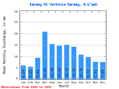
| Statistic | Jan | Feb | Mar | Apr | May | Jun | Jul | Aug | Sep | Oct | Nov | Dec | Annual |
|---|---|---|---|---|---|---|---|---|---|---|---|---|---|
| Mean | 6.09 | 5.60 | 9.40 | 20.80 | 15.47 | 14.68 | 15.12 | 14.29 | 10.76 | 9.72 | 7.71 | 7.59 | 124.47 |
| Standard Deviation | 4.04 | 3.42 | 4.46 | 11.40 | 11.21 | 9.06 | 9.05 | 5.61 | 4.32 | 6.09 | 4.86 | 4.00 | 64.05 |
| Min | 2.13 | 1.86 | 5.23 | 8.58 | 3.02 | 5.84 | 6.74 | 5.85 | 5.06 | 3.55 | 1.63 | 2.57 | 69.32 |
| Max | 10.20 | 8.56 | 14.10 | 31.16 | 27.31 | 24.55 | 27.84 | 18.62 | 16.31 | 19.42 | 14.33 | 13.48 | 194.72 |
| Coefficient of Variation | 0.66 | 0.61 | 0.47 | 0.55 | 0.72 | 0.62 | 0.60 | 0.39 | 0.40 | 0.63 | 0.63 | 0.53 | 0.52 |
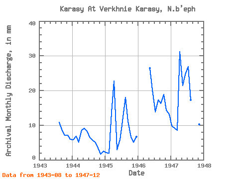
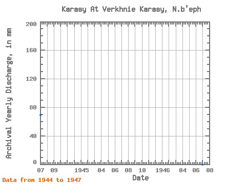
| Year | Jan | Feb | Mar | Apr | May | Jun | Jul | Aug | Sep | Oct | Nov | Dec | Annual | 1943 | 11.17 | 8.32 | 7.36 | 7.12 | 6.21 | 1944 | 5.94 | 6.38 | 5.23 | 8.58 | 9.40 | 8.24 | 6.74 | 5.85 | 5.06 | 3.55 | 1.63 | 2.57 | 69.32 | 1945 | 2.13 | 1.86 | 14.10 | 22.66 | 3.02 | 5.84 | 11.53 | 18.62 | 11.07 | 6.92 | 5.15 | 6.83 | 109.38 | 1946 | 27.31 | 20.08 | 14.37 | 17.91 | 16.31 | 19.42 | 14.33 | 13.48 | 1947 | 10.20 | 8.56 | 8.87 | 31.16 | 22.17 | 24.55 | 27.84 | 17.91 | 13.05 | 11.35 | 10.30 | 8.87 | 194.72 |
|---|
 Return to R-Arctic Net Home Page