|
|
|||||||||||||||||
| Point ID: 8745 | Downloads | Plots | Site Data | Code: 12631 |
|
|
|||||||||||||||||
| Download | |
|---|---|
| Site Descriptor Information | Site Time Series Data |
| Link to all available data | |
|
|
| View: | Statistics | Time Series |
| Units: | m3/s |
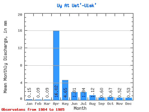
| Statistic | Jan | Feb | Mar | Apr | May | Jun | Jul | Aug | Sep | Oct | Nov | Dec | Annual |
|---|---|---|---|---|---|---|---|---|---|---|---|---|---|
| Mean | 0.12 | 0.07 | 0.07 | 12.43 | 3.61 | 1.40 | 1.43 | 0.87 | 0.47 | 0.52 | 0.41 | 0.41 | 21.83 |
| Standard Deviation | 0.10 | ||||||||||||
| Min | 0.12 | 0.07 | 0.07 | 12.43 | 3.61 | 1.40 | 1.43 | 0.87 | 0.47 | 0.52 | 0.41 | 0.34 | 21.83 |
| Max | 0.12 | 0.07 | 0.07 | 12.43 | 3.61 | 1.40 | 1.43 | 0.87 | 0.47 | 0.52 | 0.41 | 0.48 | 21.83 |
| Coefficient of Variation | 0.24 |
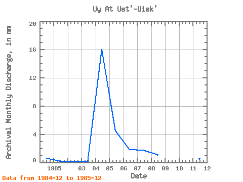
| Year | Jan | Feb | Mar | Apr | May | Jun | Jul | Aug | Sep | Oct | Nov | Dec | Annual | 1984 | 0.48 | 1985 | 0.12 | 0.07 | 0.07 | 12.43 | 3.61 | 1.40 | 1.43 | 0.87 | 0.47 | 0.52 | 0.41 | 0.34 | 21.83 |
|---|
 Return to R-Arctic Net Home Page