|
|
|||||||||||||||||
| Point ID: 8119 | Downloads | Plots | Site Data | Code: 1599 |
|
|
|||||||||||||||||
| Download | |
|---|---|
| Site Descriptor Information | Site Time Series Data |
| Link to all available data | |
|
|
| View: | Statistics | Time Series |
| Units: | m3/s |
| Statistic | Jan | Feb | Mar | Apr | May | Jun | Jul | Aug | Sep | Oct | Nov | Dec | Annual |
|---|---|---|---|---|---|---|---|---|---|---|---|---|---|
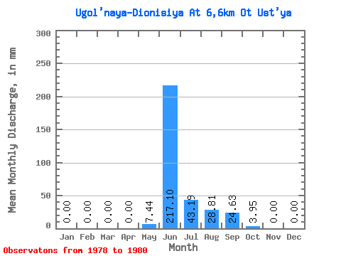
| Mean | 0.00 | 0.00 | 0.00 | 0.00 | 7.43 | 217.11 | 43.18 | 28.79 | 24.63 | 3.97 | 0.00 | 0.00 | 327.15 |
| Standard Deviation | 0.00 | 0.00 | 0.00 | 0.00 | 7.74 | 41.36 | 23.01 | 22.67 | 19.89 | 3.17 | 0.00 | 0.00 | 79.55 |
| Min | 0.00 | 0.00 | 0.00 | 0.00 | 1.15 | 188.51 | 17.91 | 12.40 | 1.87 | 0.60 | 0.00 | 0.00 | 256.01 |
| Max | 0.00 | 0.00 | 0.00 | 0.00 | 16.08 | 264.54 | 62.93 | 54.66 | 38.68 | 6.89 | 0.00 | 0.00 | 413.04 |
| Coefficient of Variation | 1.04 | 0.19 | 0.53 | 0.79 | 0.81 | 0.80 | 0.24 |
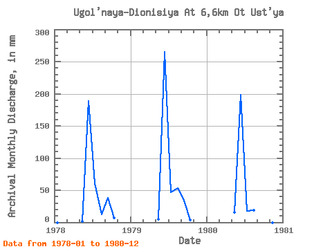
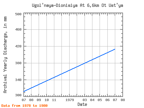
| Year | Jan | Feb | Mar | Apr | May | Jun | Jul | Aug | Sep | Oct | Nov | Dec | Annual | 1978 | 0.00 | 0.00 | 0.00 | 0.00 | 1.15 | 188.51 | 62.93 | 12.40 | 38.68 | 6.89 | 0.00 | 0.00 | 312.40 | 1979 | 0.00 | 0.00 | 0.00 | 0.00 | 5.05 | 264.54 | 48.69 | 54.66 | 33.34 | 4.41 | 0.00 | 0.00 | 413.04 | 1980 | 0.00 | 0.00 | 0.00 | 0.00 | 16.08 | 198.29 | 17.91 | 19.29 | 1.87 | 0.60 | 0.00 | 0.00 | 256.01 |
|---|
 Return to R-Arctic Net Home Page