|
|
|||||||||||||||||
| Point ID: 8417 | Downloads | Plots | Site Data | Code: 9557 |
|
|
|||||||||||||||||
| Download | |
|---|---|
| Site Descriptor Information | Site Time Series Data |
| Link to all available data | |
|
|
| View: | Statistics | Time Series |
| Units: | mm |
| Statistic | Jan | Feb | Mar | Apr | May | Jun | Jul | Aug | Sep | Oct | Nov | Dec | Annual |
|---|---|---|---|---|---|---|---|---|---|---|---|---|---|
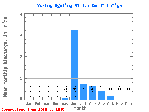
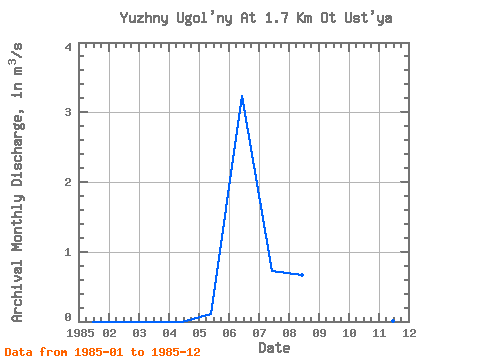
| Mean | 0.00 | 0.00 | 0.00 | 0.00 | 0.11 | 3.24 | 0.72 | 0.66 | 0.41 | 0.20 | 0.01 | 0.00 | 0.45 |
| Standard Deviation | |||||||||||||
| Min | 0.00 | 0.00 | 0.00 | 0.00 | 0.11 | 3.24 | 0.72 | 0.66 | 0.41 | 0.20 | 0.01 | 0.00 | 0.45 |
| Max | 0.00 | 0.00 | 0.00 | 0.00 | 0.11 | 3.24 | 0.72 | 0.66 | 0.41 | 0.20 | 0.01 | 0.00 | 0.45 |
| Coefficient of Variation |
| Year | Jan | Feb | Mar | Apr | May | Jun | Jul | Aug | Sep | Oct | Nov | Dec | Annual | 1985 | 0.00 | 0.00 | 0.00 | 0.00 | 0.11 | 3.24 | 0.72 | 0.66 | 0.41 | 0.20 | 0.01 | 0.00 | 0.45 |
|---|
 Return to R-Arctic Net Home Page