|
|
|||||||||||||||||
| Point ID: 9093 | Downloads | Plots | Site Data | Code: 196.35.0.1001.1 |
|
|
|||||||||||||||||
| Download | |
|---|---|
| Site Descriptor Information | Site Time Series Data |
| Link to all available data | |
| View: | Time Series | All |
| Units: | m3/s |
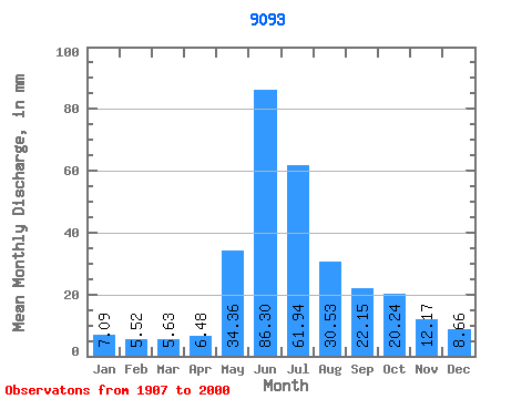
| Statistic | Jan | Feb | Mar | Apr | May | Jun | Jul | Aug | Sep | Oct | Nov | Dec | Annual |
|---|---|---|---|---|---|---|---|---|---|---|---|---|---|
| Mean | 20.69 | 16.23 | 16.42 | 18.91 | 100.20 | 251.66 | 180.60 | 89.01 | 64.60 | 59.02 | 35.48 | 25.24 | 873.60 |
| Standard Deviation | 8.60 | 6.80 | 7.58 | 8.03 | 56.96 | 64.01 | 65.45 | 32.83 | 21.56 | 25.28 | 13.72 | 9.38 | 139.38 |
| Min | 7.20 | 2.88 | 2.60 | 4.30 | 24.65 | 141.08 | 76.58 | 30.24 | 16.27 | 22.55 | 15.87 | 10.91 | 533.92 |
| Max | 46.40 | 51.60 | 51.72 | 38.88 | 306.01 | 451.59 | 385.42 | 181.43 | 162.79 | 137.81 | 76.87 | 61.85 | 1256.82 |
| Coefficient of Variation | 0.42 | 0.42 | 0.46 | 0.42 | 0.57 | 0.25 | 0.36 | 0.37 | 0.33 | 0.43 | 0.39 | 0.37 | 0.16 |
 Return to R-Arctic Net Home Page