|
|
| Point ID: 9556 | Downloads | Plots | Site Data | Code: 05060570 |
|
| Download | |
|---|---|
| Site Descriptor Information | Site Time Series Data |
| Link to all available data | |
|
|
|
| View: | Statistics | All |
| Units: | mm |
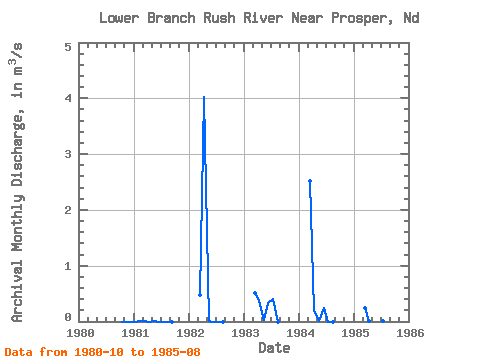
| Year | Jan | Feb | Mar | Apr | May | Jun | Jul | Aug | Sep | Oct | Nov | Dec | Annual | 1980 | 0.00 | 0.00 | 0.00 | 1981 | 0.00 | 0.01 | 0.01 | 0.00 | 0.00 | 0.00 | 0.00 | 0.00 | 0.00 | 1982 | 0.48 | 4.03 | 0.00 | 0.00 | 0.00 | 0.00 | 1983 | 0.51 | 0.37 | 0.02 | 0.32 | 0.41 | 0.00 | 1984 | 2.52 | 0.18 | 0.01 | 0.24 | 0.00 | 0.00 | 1985 | 0.24 | 0.01 | 0.85 | 0.05 | 0.00 | 0.00 |
|---|
 Return to R-Arctic Net Home Page