|
|
| Point ID: 9424 | Downloads | Plots | Site Data | Code: 15564450 |
|
| Download | |
|---|---|
| Site Descriptor Information | Site Time Series Data |
| Link to all available data | |
|
|
|
| View: | Statistics | All |
| Units: | mm |
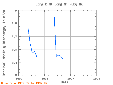
| Year | Jan | Feb | Mar | Apr | May | Jun | Jul | Aug | Sep | Oct | Nov | Dec | Annual | 1995 | 1.46 | 0.99 | 0.69 | 0.74 | 0.59 | 1996 | 2.00 | 0.59 | 0.63 | 0.61 | 0.52 | 1997 | 0.46 | 0.39 | 0.21 |
|---|
 Return to R-Arctic Net Home Page