|
|
| Point ID: 5077 | Downloads | Plots | Site Data | Code: 03AA002 |
|
| Download | |
|---|---|
| Site Descriptor Information | Site Time Series Data |
| Link to all available data | |
|
|
|
| View: | Statistics | All |
| Units: | m3/s |
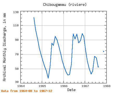
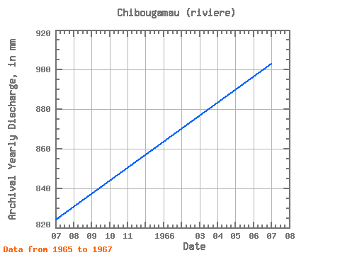
| Year | Jan | Feb | Mar | Apr | May | Jun | Jul | Aug | Sep | Oct | Nov | Dec | Annual | 1964 | 124.74 | 103.46 | 94.76 | 78.20 | 72.56 | 1965 | 63.40 | 50.47 | 48.07 | 36.55 | 53.33 | 85.51 | 84.92 | 97.74 | 89.94 | 83.32 | 70.89 | 61.57 | 824.97 | 1966 | 53.33 | 42.54 | 42.80 | 41.65 | 57.68 | 98.36 | 94.07 | 101.17 | 85.73 | 91.78 | 98.81 | 97.28 | 903.64 | 1967 | 77.14 | 55.68 | 51.27 | 42.31 | 48.52 | 67.13 | 67.06 | 54.02 | 43.87 | 50.36 | 73.99 | 76.45 | 707.85 |
|---|
 Return to R-Arctic Net Home Page