|
|
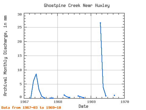
| Point ID: 397 | Downloads | Plots | Site Data | Code: 05CE012 |
|
| Download | |
|---|---|
| Site Descriptor Information | Site Time Series Data |
| Link to all available data | |
|
|
|
| View: | Statistics | All |
| Units: | m3/s |
| Year | Jan | Feb | Mar | Apr | May | Jun | Jul | Aug | Sep | Oct | Nov | Dec | Annual | 1967 | 0.00 | 4.48 | 6.46 | 2.24 | 0.52 | 0.03 | 0.00 | 0.05 | 0.04 | 1968 | 0.86 | 0.34 | 0.17 | 0.58 | 0.34 | 0.15 | 1969 | 0.00 | 19.46 | 3.00 | 0.59 | 0.82 | 0.40 | 0.74 | 1.07 |
|---|
 Return to R-Arctic Net Home Page