Konda at Urai
Ob
| PointID: | 7091 |
Code: | 11521 |
Latitude (decimal degrees): | 60.15 |
Longitude (decimal degrees): | 64.83 |
Drainage Area (km2): | 23400.00 |
Source: | SHI |
Hydrological Zone: | Ob |
Name: | Konda at Urai |
Field Definitions
Site Time Series Plot:
Site Data File:
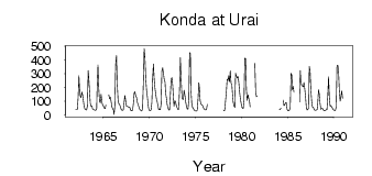
(Units: m3/s)
| ID | Year | Jan | Feb | Mar | Apr | May | Jun | Jul | Aug | Sep | Oct | Nov | Dec |
|---|
| 7091 | 1962 | 41.80 | 40.50 | 40.70 | 128.00 | 287.00 | 166.00 | 134.00 | 126.00 | 168.00 | 146.00 | 99.70 | 56.30 |
| 7091 | 1963 | 42.80 | 38.20 | 37.50 | 65.40 | 323.00 | 279.00 | 179.00 | 87.20 | 62.20 | 65.50 | 43.70 | 40.50 |
| 7091 | 1964 | 36.40 | 35.50 | 35.70 | 44.20 | 209.00 | 364.00 | 197.00 | 96.30 | 89.40 | 150.00 | 92.80 | 72.30 |
| 7091 | 1965 | 64.90 | 50.90 | 45.80 | 70.80 | | | | 146.00 | 118.00 | 129.00 | 97.30 | 59.10 |
| 7091 | 1966 | 44.10 | 35.50 | 3.81 | 69.90 | 368.00 | 434.00 | 229.00 | 113.00 | 81.80 | 76.10 | 59.70 | 40.50 |
| 7091 | 1967 | 35.00 | 35.50 | 36.80 | 91.30 | 142.00 | 102.00 | 63.90 | 64.00 | 60.90 | 56.00 | 58.30 | 36.90 |
| 7091 | 1968 | 30.50 | 30.80 | 32.50 | 78.50 | 159.00 | 169.00 | 138.00 | 129.00 | 92.30 | 75.80 | 58.60 | 44.80 |
| 7091 | 1969 | 36.80 | 30.40 | 29.50 | 46.80 | 242.00 | 486.00 | 413.00 | 267.00 | 180.00 | 134.00 | 71.40 | 47.50 |
| 7091 | 1970 | 33.70 | 31.50 | 36.60 | 91.40 | 267.00 | 371.00 | 258.00 | 193.00 | 149.00 | 110.00 | 101.00 | 66.20 |
| 7091 | 1971 | 39.40 | 44.20 | 40.00 | 79.80 | 322.00 | 344.00 | 301.00 | 258.00 | 240.00 | 163.00 | 128.00 | 77.00 |
| 7091 | 1972 | 52.20 | 37.40 | 36.80 | 141.00 | 262.00 | 272.00 | 217.00 | 110.00 | 64.00 | 105.00 | 94.80 | 65.70 |
| 7091 | 1973 | 52.50 | 38.40 | 43.00 | 196.00 | 418.00 | 257.00 | 133.00 | 116.00 | 112.00 | 182.00 | 147.00 | 97.50 |
| 7091 | 1974 | 63.40 | 45.30 | 42.30 | 110.00 | 455.00 | 449.00 | 188.00 | 84.50 | 57.30 | 46.60 | 36.70 | 31.30 |
| 7091 | 1975 | 29.30 | 29.50 | 35.90 | 120.00 | 235.00 | 198.00 | 105.00 | 76.70 | 75.30 | 70.10 | 54.10 | 42.30 |
| 7091 | 1976 | 38.40 | 36.70 | 40.50 | 78.40 | | | | | | | | |
| 7091 | 1978 | 36.50 | 31.90 | 36.00 | 102.00 | 166.00 | 261.00 | 250.00 | 288.00 | 242.00 | 321.00 | 232.00 | 220.00 |
| 7091 | 1979 | 139.00 | 92.20 | 67.50 | 54.00 | 305.00 | 283.00 | 270.00 | 281.00 | 242.00 | 171.00 | 119.00 | 87.00 |
| 7091 | 1980 | 62.60 | 50.30 | 46.00 | 109.00 | 415.00 | 413.00 | 186.00 | 107.00 | 146.00 | 119.00 | 94.30 | 59.10 |
| 7091 | 1981 | | | | | | 375.00 | 169.00 | 134.00 | 138.00 | | | |
| 7091 | 1984 | | 42.30 | 41.60 | 50.80 | | | 108.00 | 67.50 | 71.40 | 89.50 | 90.30 | 42.10 |
| 7091 | 1985 | 31.40 | 31.40 | 34.70 | 60.60 | 304.00 | 291.00 | 186.00 | 208.00 | 166.00 | | | |
| 7091 | 1986 | | | | 95.60 | 324.00 | 254.00 | 216.00 | 213.00 | 205.00 | 237.00 | 189.00 | 132.00 |
| 7091 | 1987 | 49.90 | 37.20 | 41.80 | 52.10 | 354.00 | 324.00 | 188.00 | 101.00 | 58.40 | 58.90 | 43.30 | 34.70 |
| 7091 | 1988 | 35.50 | 37.70 | 39.20 | 81.80 | 184.00 | 152.00 | 83.90 | 41.20 | 46.00 | 48.00 | 36.40 | 30.70 |
| 7091 | 1989 | 30.40 | 33.40 | 38.20 | 38.30 | 139.00 | 279.00 | 130.00 | 63.10 | 68.80 | 58.50 | 49.50 | 39.80 |
| 7091 | 1990 | 35.60 | 33.20 | 33.80 | 62.20 | 359.00 | 365.00 | 314.00 | 169.00 | 100.00 | 136.00 | 175.00 | 121.00 |
| Other Close Sites |
|---|
| PointID |
Latitude |
Longitude | Drainage Area | Source |
Name |
|---|
| 7092 | 60.15 | 64.83 | 41200.00 | SHI | Konda at Mejdurechenskyi |
 Return to R-Arctic Net Home Page