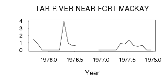
| PointID: | 714 | Code: | 07DA015 | Latitude (decimal degrees): | 57.35 | Longitude (decimal degrees): | -111.75 | Drainage Area (km2): | 301.00 | Source: | Hydat | Hydrological Zone: | Mackenzie | Name: | TAR RIVER NEAR FORT MACKAY |
|---|
| Download | |
|---|---|
| Site Descriptor Information | Site Time Series Data |
| Link to all available data | |
| ID | Year | Jan | Feb | Mar | Apr | May | Jun | Jul | Aug | Sep | Oct | Nov | Dec |
|---|---|---|---|---|---|---|---|---|---|---|---|---|---|
| 714 | 1975 | 1.49 | 0.85 | 0.00 | 0.00 | ||||||||
| 714 | 1976 | 0.00 | 0.00 | 0.00 | 4.00 | 0.93 | 0.60 | 0.71 | 0.00 | ||||
| 714 | 1977 | 0.00 | 0.00 | 0.00 | 0.00 | 0.90 | 0.82 | 1.40 | 0.62 | 0.52 | 0.66 | 0.00 | 0.00 |
 Return to R-Arctic Net Home Page