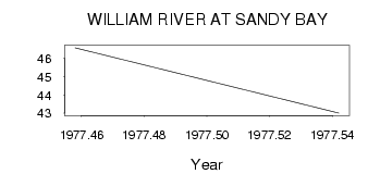
| PointID: | 5620 | Code: | 07MA005 | Latitude (decimal degrees): | 59.13 | Longitude (decimal degrees): | -109.30 | Drainage Area (km2): | 5970.00 | Source: | Hydat | Hydrological Zone: | Mackenzie | Name: | WILLIAM RIVER AT SANDY BAY |
|---|
| Download | |
|---|---|
| Site Descriptor Information | Site Time Series Data |
| Link to all available data | |
| ID | Year | Jan | Feb | Mar | Apr | May | Jun | Jul | Aug | Sep | Oct | Nov | Dec |
|---|---|---|---|---|---|---|---|---|---|---|---|---|---|
| 5620 | 1977 | 46.60 | 43.00 |
 Return to R-Arctic Net Home Page