|
|
| Point ID: 9397 | Downloads | Plots | Site Data | Code: 15880000 |
|
| Download | |
|---|---|
| Site Descriptor Information | Site Time Series Data |
| Link to all available data | |
|
|
|
| View: | Statistics | All |
| Units: | mm |
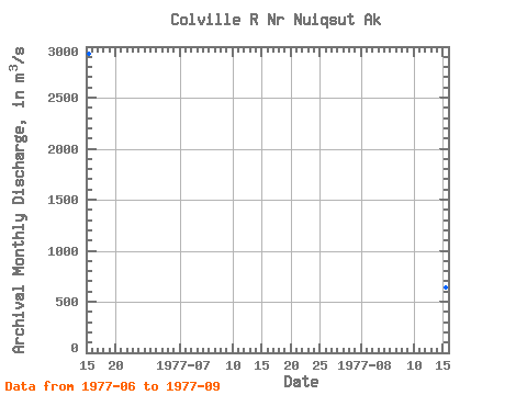
| Year | Jan | Feb | Mar | Apr | May | Jun | Jul | Aug | Sep | Oct | Nov | Dec | Annual | 1977 | 2930.41 | 612.56 | 637.13 | 418.24 |
|---|
 Return to R-Arctic Net Home Page