|
|
| Point ID: 4384 | Downloads | Plots | Site Data | Code: 05PA001 |
|
| Download | |
|---|---|
| Site Descriptor Information | Site Time Series Data |
| Link to all available data | |
|
|
|
| View: | Statistics | All |
| Units: | mm |
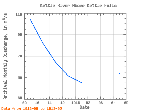
| Year | Jan | Feb | Mar | Apr | May | Jun | Jul | Aug | Sep | Oct | Nov | Dec | Annual | 1912 | 104.00 | 82.10 | 63.90 | 51.40 | 1913 | 45.40 | 39.70 | 36.30 | 53.70 | 187.00 |
|---|
 Return to R-Arctic Net Home Page