|
|
|||||||||||||||||
| Point ID: 3598 | Downloads | Plots | Site Data | Code: 10EA004 |
|
|
|||||||||||||||||
| Download | |
|---|---|
| Site Descriptor Information | Site Time Series Data |
| Link to all available data | |
|
|
| View: | Statistics | Time Series |
| Units: | m3/s |
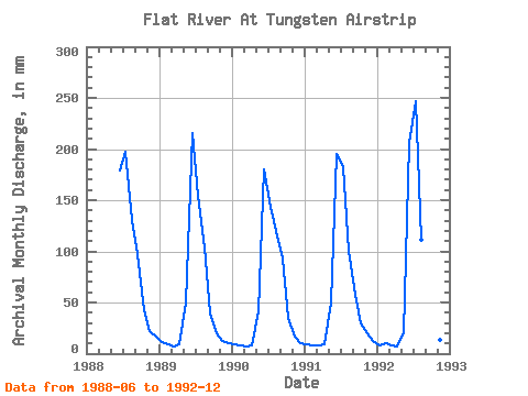
| Statistic | Jan | Feb | Mar | Apr | May | Jun | Jul | Aug | Sep | Oct | Nov | Dec | Annual |
|---|---|---|---|---|---|---|---|---|---|---|---|---|---|
| Mean | 9.87 | 8.21 | 7.76 | 8.32 | 41.66 | 195.23 | 191.06 | 116.86 | 65.18 | 30.73 | 16.61 | 12.41 | 684.50 |
| Standard Deviation | 1.59 | 1.03 | 0.70 | 1.03 | 14.76 | 15.88 | 42.01 | 12.74 | 28.59 | 9.32 | 3.87 | 2.67 | 24.96 |
| Min | 8.69 | 7.11 | 6.89 | 7.32 | 20.36 | 178.86 | 148.78 | 103.83 | 38.20 | 20.52 | 12.61 | 10.32 | 652.72 |
| Max | 12.21 | 9.38 | 8.44 | 9.55 | 51.99 | 215.24 | 255.27 | 134.68 | 97.16 | 43.38 | 21.52 | 16.91 | 713.01 |
| Coefficient of Variation | 0.16 | 0.13 | 0.09 | 0.12 | 0.35 | 0.08 | 0.22 | 0.11 | 0.44 | 0.30 | 0.23 | 0.21 | 0.04 |
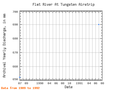
| Year | Jan | Feb | Mar | Apr | May | Jun | Jul | Aug | Sep | Oct | Nov | Dec | Annual | 1988 | 178.86 | 203.59 | 134.68 | 97.16 | 43.38 | 21.52 | 16.91 | 1989 | 12.21 | 8.75 | 7.50 | 9.55 | 51.21 | 215.24 | 159.74 | 106.65 | 39.56 | 20.52 | 12.61 | 11.04 | 652.72 | 1990 | 9.24 | 7.11 | 6.89 | 7.62 | 43.07 | 180.38 | 148.78 | 124.19 | 93.52 | 36.02 | 16.37 | 10.32 | 681.65 | 1991 | 9.33 | 7.62 | 8.19 | 8.78 | 51.99 | 195.54 | 187.93 | 103.83 | 57.45 | 30.38 | 19.40 | 12.72 | 690.63 | 1992 | 8.69 | 9.38 | 8.44 | 7.32 | 20.36 | 206.15 | 255.27 | 114.95 | 38.20 | 23.34 | 13.16 | 11.07 | 713.01 |
|---|
 Return to R-Arctic Net Home Page
