|
|
|||||||||||||||||
| Point ID: 233 | Downloads | Plots | Site Data | Code: 05BA011 |
|
|
|||||||||||||||||
| Download | |
|---|---|
| Site Descriptor Information | Site Time Series Data |
| Link to all available data | |
|
|
| View: | Statistics | Time Series |
| Units: | m3/s |
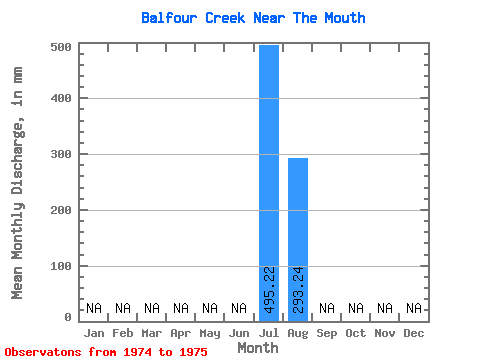
| Statistic | Jan | Feb | Mar | Apr | May | Jun | Jul | Aug | Sep | Oct | Nov | Dec | Annual |
|---|---|---|---|---|---|---|---|---|---|---|---|---|---|
| Mean | 495.14 | 293.20 | |||||||||||
| Standard Deviation | 148.68 | 20.12 | |||||||||||
| Min | 390.01 | 278.97 | |||||||||||
| Max | 600.28 | 307.43 | |||||||||||
| Coefficient of Variation | 0.30 | 0.07 |
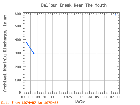
| Year | Jan | Feb | Mar | Apr | May | Jun | Jul | Aug | Sep | Oct | Nov | Dec | Annual | 1974 | 390.01 | 307.43 | 1975 | 600.28 | 278.97 |
|---|
 Return to R-Arctic Net Home Page