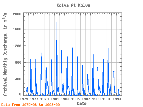
Kolva At Kolva
North European Russia

Point ID: 7507Downloads | Plots | Site Data Code: 70501

Latitude: 66.55°Distance to Outlet: 137.00
Longitude: 56.77°Yearly Min: 1975
X EASE-Grid: 2166019.00Yearly Max: 1993
Y EASE-Grid: -1419023.00Number of Years: 19
Drainage Area: 15000.00 km2Percentage of Coverage: 100%
Drainage Area Effective: 15000.00 km2Percentage of Coverage by Month: 85%
Source: SHINotes:
Gauge Altitude: 38.54


Field Definitions

Download
Site Descriptor Information Site Time Series Data
Link to all available data


Site Time Series Plot

Site Data:
View: Statistics Time Series All
Units: mm m3/s

Summary Statistics

Unable to open file ./Points/Stats7507 Arcticnet_ms.txtfor reading!
StatisticJanFebMarAprMayJunJulAugSepOctNovDecAnnual