|
|
|||||||||||||||||
| Point ID: 5456 | Downloads | Plots | Site Data | Other Close Sites | Code: 05KH010 |
|
|
|||||||||||||||||
| Download | |
|---|---|
| Site Descriptor Information | Site Time Series Data |
| Link to all available data | |
|
|
| View: | Statistics | Time Series |
| Units: | mm |
| Statistic | Jan | Feb | Mar | Apr | May | Jun | Jul | Aug | Sep | Oct | Nov | Dec | Annual |
|---|---|---|---|---|---|---|---|---|---|---|---|---|---|
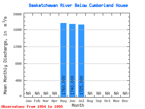
| Mean | 1760.00 | 1740.00 | 1725.00 | ||||||||||
| Standard Deviation | 233.34 | ||||||||||||
| Min | 1760.00 | 1740.00 | 1560.00 | ||||||||||
| Max | 1760.00 | 1740.00 | 1890.00 | ||||||||||
| Coefficient of Variation | 0.14 |
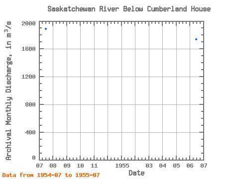
| Year | Jan | Feb | Mar | Apr | May | Jun | Jul | Aug | Sep | Oct | Nov | Dec | Annual | 1954 | 1890.00 | 1955 | 1760.00 | 1740.00 | 1560.00 |
|---|
| Other Close Sites | ||||||
|---|---|---|---|---|---|---|
| PointID | Latitude | Longitude | Drainage Area | Source | Name | |
| 5454 | "SASKATCHEWAN RIVER NEAR MANITOBA BOUNDARY" | 53.88 | 809175 | Hydat | ||
 Return to R-Arctic Net Home Page